

Ok! So here I am quarantining in Scotland at Lucy’s parents house (thank you!). Seriously, given that Lucy is busy off being a doctor and having direct patient contact, it would not be great if a germ ridden American was cohabitatating with her. If it wasn’t for Lucy’s parents, my return to Scotland would be much more complicated. Quarantine has been fine though. The best part is I don’t have to be a paramedic anymore which means I can grow a beard again! Additionally, I have checked the stock market 32 times a day to evaluate Dunkin’ Donuts, learned how to make a box out of paper, reorganized the photos on my phone, alphabetized my high school english papers, and planned another long walk. Only two of those are true.
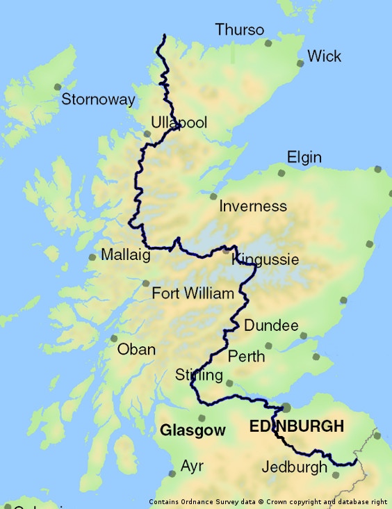
The Scottish National Trail covers the entire length of Scotland and is more of a concept than a trail. There is no official path, but rather a linking of various sections of other trails together (sometimes with no trail at all) to get from the border with England at Kirk Yetholms to the northern point of Scotland at Cape Wrath. This walk is roughly 536 miles and provides a variety of challenges that differ widely from long distance hikes in the United States; mainly, lack of PBR availability. Along with that, one of the largest considerations involves swapping out some equipment to be better prepared for the unpredictable and consistently rainy and windy Scottish climate.
Tent
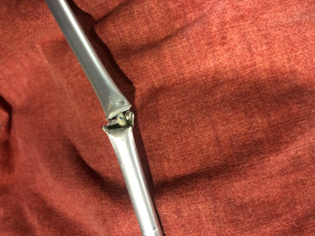
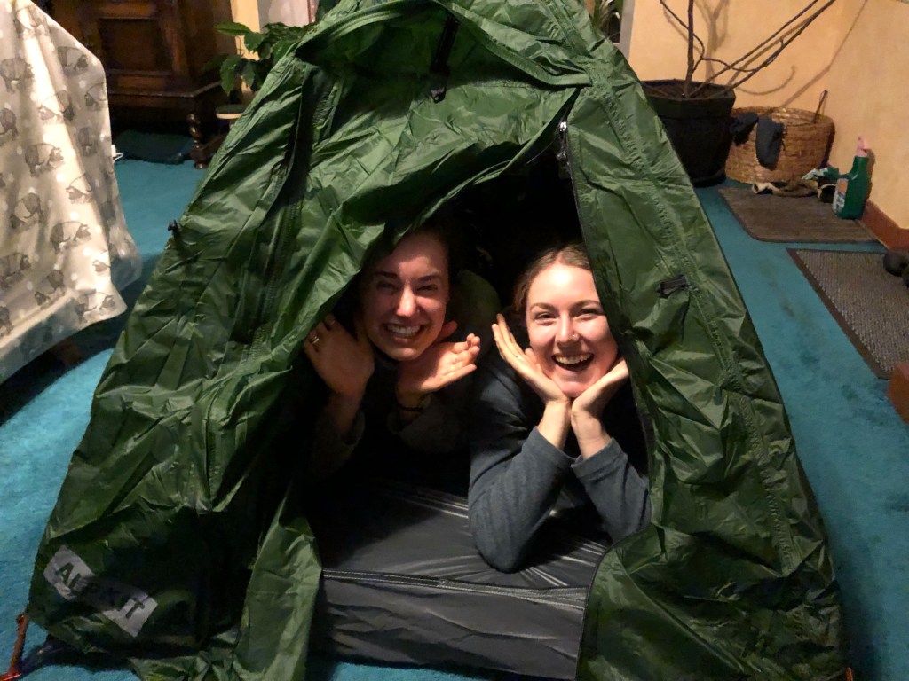
Last winter I learned that my lightweight thru-hiking tent does not stand up to this climate while camping on the west coast of Ireland with Fiona and Joe. The strong multi-directional gusts snapped a pole in half at roughly 2am. That with driving rain on an ultralight fly will result in a very cold, wet night. So I am swapping out my Big Agnes Tigerwall UL 2 for Lucy’s Alpkit Soloist tent. This tent is about 6 ounces heavier and has a smaller interior, but the trade off is a no brainer if it is the difference between sleeping dry or not. Additionally, while I normally carry only 6 stakes, I will be carrying 10 for the SNT to have the ability to peg out all of the guy lines for maximal protection in bad conditions. Sounds fun already, right?

Pack
For the AT and CT I used an Osprey Atmos 65L pack which has served me very well. Osprey makes an incredible product, and although heavier, their antigravity strap system truly reduces the amount of “felt weight”. I have played around with using the commercial rain cover and lining my pack with a compacter bag, both of which are successful in different ways but neither completely effective. One of the more common bags you will see on a long trail is made in Biddeford, Maine at Hyperlite Mountain Gear. I finally bit the bullet and decided to switch packs- a difficult decision when you have something tried and true that you’ve trusted for thousands of miles. I will be using the HMG Junction 3400. The claim to fame for Hyperlite Packs is the Dyneema Composite fabric that is meant to be 100% waterproof. I will certainly be putting this to the test over the next month and a bit. Conversely to all of the other gear changes, this pack is significantly lighter than the Osprey, the trade off here is comfort.
Shoes
For all of the AT, CT, and trail races around the world, I have used the Salomon Speedcross 4. It’s a 10mm drop with decent tread that holds up great in slick conditions. Generally, I have been able to get 500-600 miles on these shoes before needing to swap them out, mostly due to tearing in the lateral and medial flexion points. But, I’m not sure I’ve ever spent a single day in the mountains in Scotland without getting wet feet. Underfoot, the ground is constantly soaked through at some point in your day, and if its not, wait an hour. On the SNT I will be wearing the Salomon Speedcross 5 GTX; the Gortex model of my normal shoe. Normally I refrain from Goretex footwear because of the lack of breathability, but I’m willing to experiment with these in this environement.
Rain Gear
I found out very quickly when I first came to Scotland in October 2018 after the AT that my ultralight rain gear was largely inadequate. The sheer force of rainfall is very different than what I experienced while hiking from Georgia to Maine. My normal rainwear in Scotland is an Arctery’x Beta LT jacket and Marmot Precip pants which are obviously heavier than what I wear in America. My normal Outdoor Research Helium II jacket is 6.2 ounces lighter while there is an 8.1 ounce difference from my Enlightened Equipment Visp pants. So all together, it will be adding about a pound to my base weight, but in Scotland, proper rain gear is something you can never compromise on.
Midlayer
One of the largest mistakes that people new to backpacking make is packing way too many clothes. It’s one of the most common ways to drop excess weight from your pack. You really do not need much. But there is always a heated debate over the “mid layer”. Ideally, everything in your pack should have multiple uses. My rain jacket is normally one of my most worn pieces of apparel on a thru-hike, but its very rarely worn in the rain. It has generally served as this intermediate layer when it’s cold in the morning/evening, or windy up on a ridge. However, Scotland in September and October will require a bit of extra warmth and comfort. I’ll be carrying my Melanzana Microgrid hoodie adding another 12 ounces to my pack.

Navigation
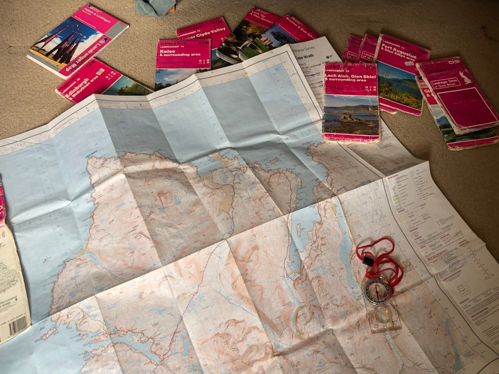
When Fiona and Joe visited last summer and then in the last few months in America with Lucy, they were all surprised by how well marked the trails were in America. I hiked the AT without a map. I don’t know anyone who has hiked the AT with a map. You don’t need one, you follow the White Blazes forever. You cannot go into the wilderness in Scotland without a map, EVER. There are very rarely marked paths and often times there is no path at all necessitating exemplary map and compass skills. So more added weight will be in the form of my compass and whichever maps I need for the section I am on. Since the SNT is a piecing together of various bits of other walks, there is not one collective map. The route I am taking will require 21 different Ordinance Survey maps to make it to the end at Cape Wrath. Luckily, I will be able to swap maps out with Lucy when she comes to visit at various points along the way.
With all that being said, I have added two pounds (depending on maps) to my pack making my baseweight top out at 14.7 pounds. Then add 12 pounds in water weight for being drenched in a rain storm 85% of the time.
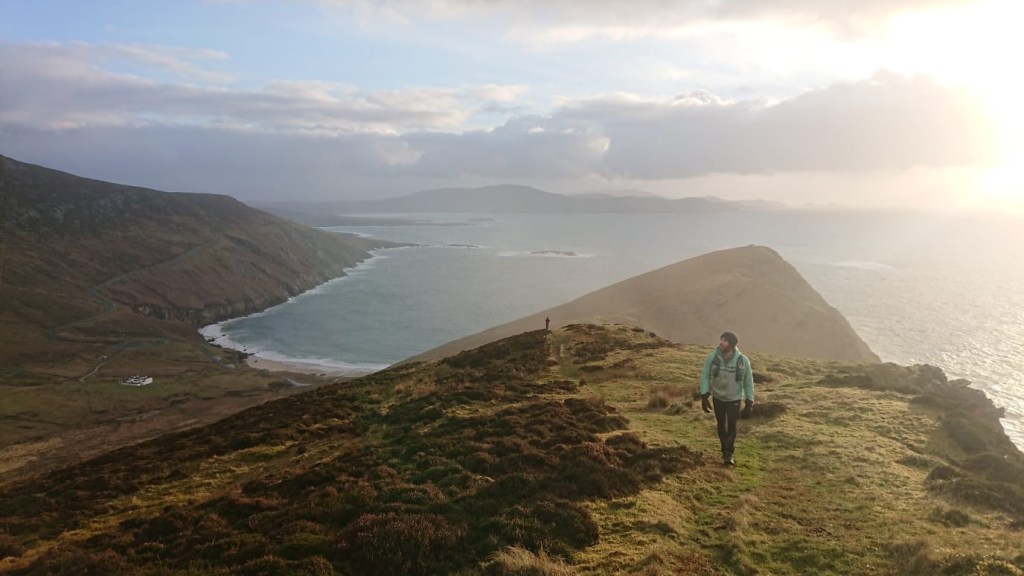
This walk feels like much more of an adventure than my other thru-hikes. It has required careful planning and logistics as there is not nearly as much information available on the SNT as there are for the AT and CT. And although the beginning of the trek will be relatively urban, going through many villages as I make my way North to Edinburgh, the second half is totally wild. I anticipate the stretch to Cape Wrath being very isolated and magical as it is one of the most remote parts of the country. It will be an entirely different experience than the AT.
Luckily, there are friends who will join along the way so it won’t always be all that lonely. I’m very lucky that Lucy has offered some of her days off to come walk bits and pieces with me. Then as I make my way further North through Kingussie, Fiona, Joe and more reindeer friends will tag along as I make my way North. The Scottish National Trail will begin for me on September 21st! As always, I will be using the Spot GPS device so you can track my progress and I will also be doing weekly blog updates. Thank you for following along!
***Disclaimer, this walk will go nowhere near Loch Ness, so if I do find Nessie, I will gain much fame, but I also definitely took a wrong turn***
Peace,
Handy Man
September 6, 2020
Thornhill, Scotland

Off on another adventure! I know how much prep and planning goes into these trips. I hope you enjoy the journey, and I am very grateful for the Spot tracker…….I look forward to that pin drop every night :). Enjoy, be safe……love you, Mom
LikeLiked by 1 person
I noticed you also have a high quality compass. That makes me happy; with the conditions you described for trails and topography you obviously need it.
It was good to see you at the ATS webinar a couple of weeks ago. Your talk was superb.
LikeLiked by 1 person
Unfortunately I think too many people don’t know how to use a compass Walt! It’s crazy! Thanks for listening to my talk and for the kind words. Hope you’re doing well!
LikeLike
I am so excited to follow you on another adventure. Good luck!
LikeLiked by 1 person
Looking forward to your updates. Be safe and well.
LikeLiked by 1 person
It’s not ALWAYS wet here… Honest!
Looking forward to hearing about this next adventure, and seeing you at some point too!
LikeLiked by 1 person
Debatable! 😂 Yes! Will definitely be making a detour into Reindeer House so will be great to catch up!
LikeLike
Looking forward to following along this journey with you. Be safe, stay healthy and as always much love to you ❤️
LikeLike
❤️
LikeLike